290 Toll
A 6-mile toll road along US 290 from US 183 to SH 130 in east Austin
Those looking to bypass traffic congestion have a choice to use 290 Toll. Drivers who prefer not to pay a toll can use the improved non-tolled general purpose lanes.
290 Toll upgraded the existing US 290 to a new expressway facility, which tripled the roadway’s capacity. It includes three tolled mainlanes and three non-tolled general-purpose lanes in each direction along US 290 from US 183 interchange to the eastern limits east of SH 130, with direct connectors at both US 183 and SH 130. The project has significantly improved travel times for both tolled and non-tolled movement.
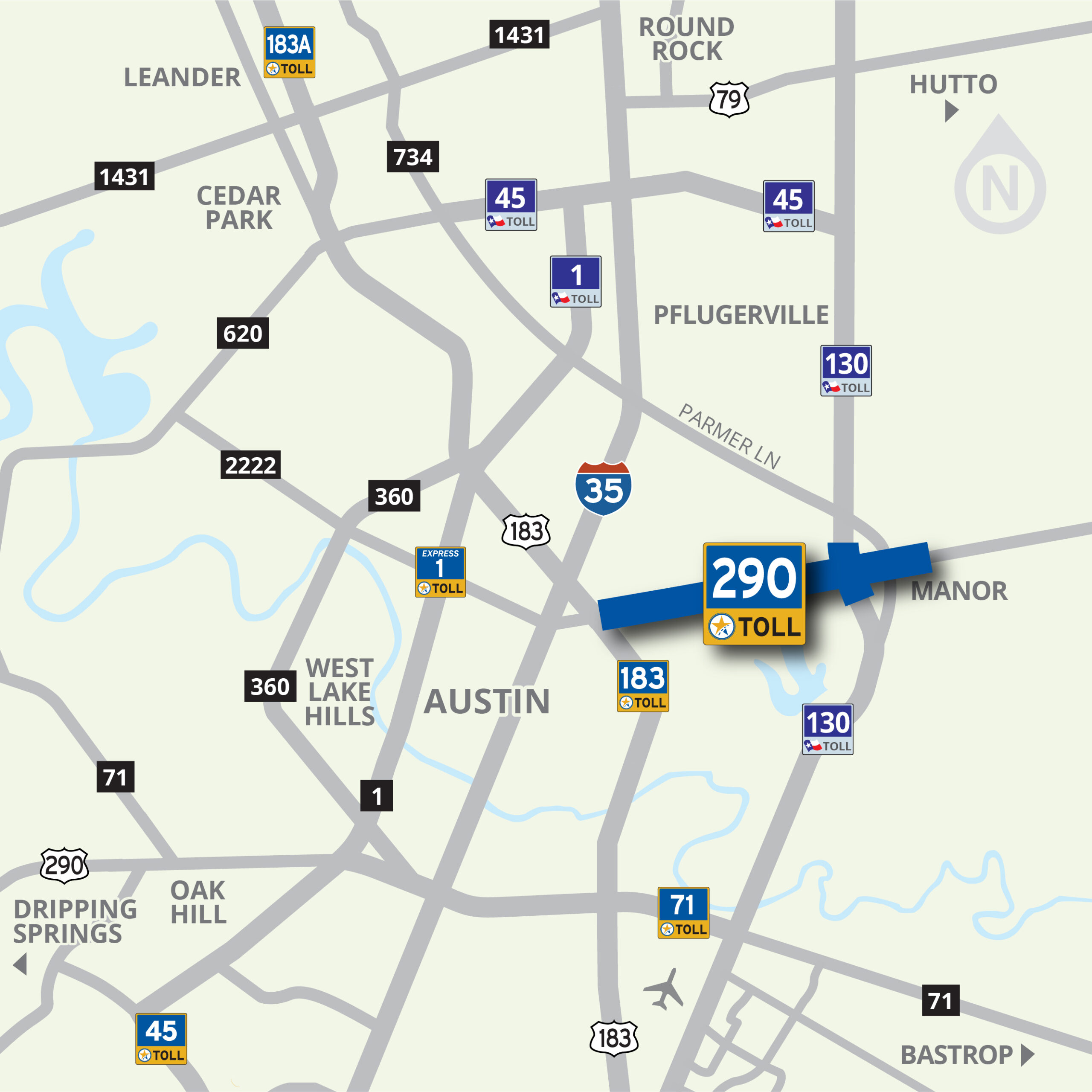
As the region grows, the Mobility Authority is exploring the feasibility of an eastern extension of the toll road into Manor.
Use Your Electronic Tag or Drive on Through, We’ll Bill You
290 Toll is completely automated with no need to stop or even slow down at toll booths.
The choice is yours – utilize the all-electronic, or cashless, tolling method of payment through an electronic tag account; or if you don’t have an electronic tag just keep moving, and we’ll bill you through the Pay By Mail program.
In Texas, there are multiple transportation agencies that are authorized to operate toll roads, issue their own electronic tag, and do their own billing. In the Austin area, there are two: the Texas Department of Transportation (TxDOT/TxTag) and the Central Texas Regional Mobility Authority (Mobility Authority).
Mobility Authority customers can pay their tolls with a TxTAG, TollTag, EZ TAG, K-TAG, Pikepass, SunPass, E-470’s ExpressToll or Bancpass and get a 33% discount, or they can choose to Pay By Mail. Pay By Mail customers are billed using a picture of their license plate, and are charged a $1.00 statement fee per bill. Vehicle registration information must be up to date in order for the bill to be sent to the correct address. Pay By Mail is available on all toll roads in Central Texas, although you may receive separate bills depending on which agency operates the road you traveled on.
To learn about paying your tolls, see the download available below.
290 Toll: 2024 Rates
 |
2 Axle | 3 Axle | 4 Axle | 5 Axle | 6 Axle | |||||
|---|---|---|---|---|---|---|---|---|---|---|
| TxTag | Pay by Mail | TxTag | Pay by Mail | TxTag | Pay by Mail | TxTag | Pay by Mail | TxTag | Pay by Mail | |
| U.S. 183 Ramps (Direct Connectors) | $0.71 | $1.07 | $1.42 | $2.14 | $2.13 | $3.21 | $2.84 | $4.28 | $3.55 | $5.35 |
| Springdale Road Ramps | $0.71 | $1.07 | $1.42 | $2.14 | $2.13 | $3.21 | $2.84 | $4.28 | $3.55 | $5.35 |
| Giles Lane Ramps | $0.71 | $1.07 | $1.42 | $2.14 | $2.13 | $3.21 | $2.84 | $4.28 | $3.55 | $5.35 |
| Giles Lane Mainline Plaza | $1.45 | $2.18 | $2.90 | $4.36 | $4.35 | $6.54 | $5.80 | $8.72 | $7.25 | $10.90 |
| Harris Branch Parkway Ramps | $0.71 | $1.07 | $1.42 | $2.14 | $2.13 | $3.21 | $2.84 | $4.28 | $3.55 | $5.35 |
| Parmer Lane Mainline Plaza | $0.71 | $1.07 | $1.42 | $2.14 | $2.13 | $3.21 | $2.84 | $4.28 | $3.55 | $5.35 |
| 290/130 Flyover | $0.73 | $1.10 | $1.46 | $2.20 | $2.19 | $3.30 | $2.92 | $4.40 | $3.65 | $5.50 |
Learn More About the 290 Toll
Want more information fast? Download the fact sheet below on 290 Toll.
Phases I, II, & III
Phase I. The first phase that was developed and constructed by the Mobility Authority consisted of four tolled direct connectors and associated pavement at the US 183 interchange to provide direct access to and from the 290 Toll mainlanes. Federal stimulus funding was allocated to help complete this phase. Phase I was open to traffic in late 2012.
Phase II. The second phase was a 6.2-mile toll road consisting of three tolled mainlanes and three non-tolled general-purpose lanes in each direction from the US 183 interchange to the eastern limits east of SH 130. It opened to traffic in May 2014.
Intersection Improvements. An interim intersection improvement project was initiated in 2015 to address a mobility and safety issue at the intersection of the westbound frontage roads of 290 Toll and the southbound SH 130 frontage roads. This interim solution consisted of the addition of dual right turn lanes on southbound SH130 frontage road, the addition of a southbound through-lane on the frontage road, the extension of the merge of the sweeping right turn, the addition of an extra lane on the westbound entrance ramp to the 290 Toll mainlanes, and additional signage. The project was completed and opened to traffic in September 2016.
Phase III. The Mobility Authority, in coordination with TxDOT, constructed three direct connectors at the SH 130 interchange. These bridges give drivers free-flowing direct connections between the two facilities and frees up capacity on the frontage road intersection. The north-to-west and south-to-west direct connectors are tolled, and the east-to-south director is non-tolled. A flyover already existed linking eastbound 290 Toll to northbound SH 130, which remains non-tolled.
Bicycle & Pedestrian Facilities. 290 Toll Shared Use Path includes a 10-foot-wide, 5-mile long shared use path on the south side of the 290 Toll frontage road from the US 183 interchange to east of SH 130. The bicycle and pedestrian facility includes a dedicated Shared Use Path bridge at the Walnut Creek Tributary and accommodates connections to 183 Trail and the future Walnut Creek Shared Use Path.

Publications and Resources
Study Report
-
01.
Maps and Images
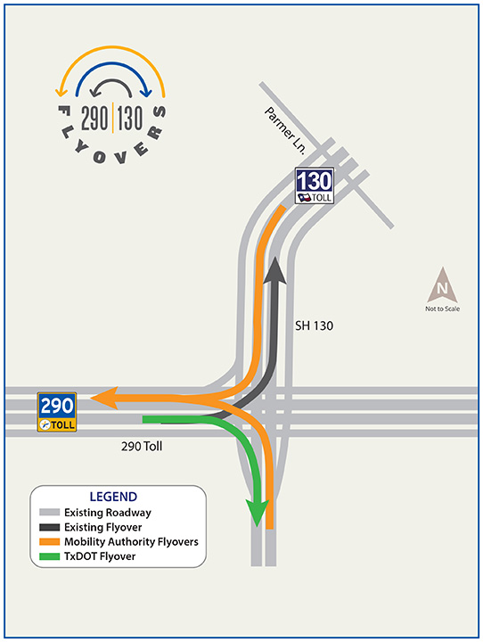
290 Toll Phase III
-
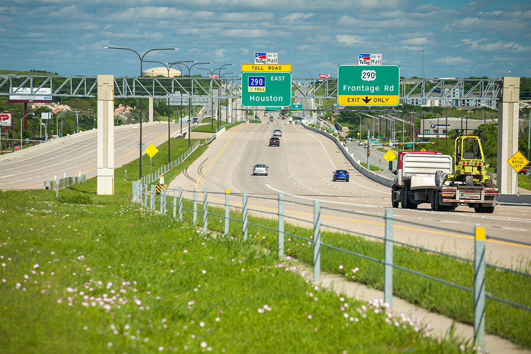
290 Toll Road -
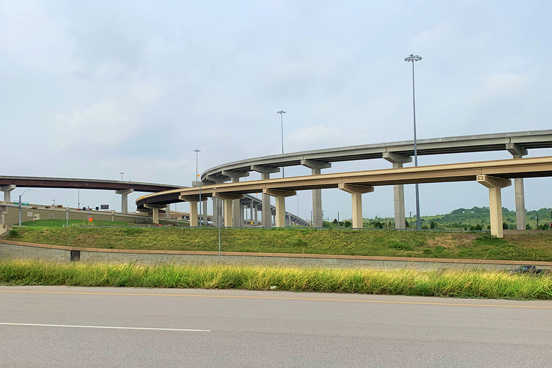
290/130 Flyovers -

290 Toll Road -

290/130 Flyovers -

290 Toll Road -

290/130 Flyovers

